
- Show trip
- Add to bucket listRemove from bucket list
- Share
- Apr 2, 2024, 2:37pm
- ☀️ 15 °C
- Altitude: 2,661 m
 NepalProvince 1SolududhkundaJunbesiMenjuṅ Kholā27°34’51” N 86°32’47” E


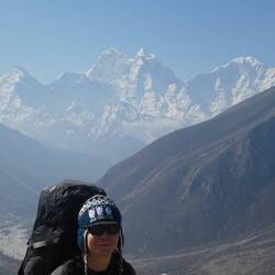
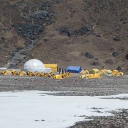
Day 13
Day 13: Pikey Peak Base Camp to Junbesi
 April 2 in Nepal ⋅ ☀️ 15 °C
Slept up against the outdoor wall of the shack at base camp, I spent the night huddled up with my water filter and electronics in my sleeping bag with me to save them from the bitter cold wind whichRead more


Traveler Wowee, u two almost on the top of the world, not quite! But first of many...🤞🤞👏👏x
Traveler Yes great view!