- 旅行を表示する
- 死ぬまでにやっておきたいことリストに追加死ぬまでにやっておきたいことリストから削除
- 共有
- 日161
- 2023年5月22日月曜日 8:35
- ☀️ 24 °C
- 海抜: 3,241 フィート
マラウイCholo Mountain16°5’24” S 35°4’0” E
Southern Malawi

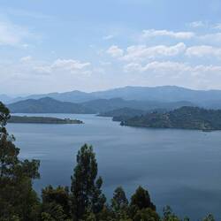
After a crazy week of travel in northern Mozambique I headed straight to Monkey Bay on the southern tip of Lake Malawi to decompress. I stayed at a rustic little eco lodge with a pod of hippos living nearby that you can hear at night! What they didn't tell me before I arrived was that due to cyclone Freddy the lake levels were high, which meant I had to wade through thigh high water to get there. I was only worried about the leeches and schistosomiasis (fresh water parasite) at the time and only learnt about the hippos and crocodiles in the area after! Luckily on the way back out a couple of days later I got a lift on a canoe. Next I went to Cape MacClear a few km further along the lake for more of the same, except with a more lively backpacker scene, where I met some nice people to chill and go on a sunset boat trip with.
Once I felt sufficiently rested, I got back on the minibus to head to Zomba, the old colonial capital with some pretty nice historical buildings. Zomba rests at the base of a high plateau which I went on a nice hike on to see some view points of the area, and a nice waterfall. Next I went onto Mulanje, the highest mountain in Malawi. To climb it would be a 3 day hike which I didn't have the time or the energy for, so I settled for a nice day hike on the mountain, seeing more nice viewpoints and waterfalls. My favourite part was visiting the tea plantations in the area by motorbike which looked really striking with the luminous green tea leaves, the burnt red earth, and the mountains rising dramatically out of the landscape in the background.
Then onto Blantyre which I used as a base to visit Satemwa Tea Estate, one of the oldest tea estates in Malawi, established in 1923. I went to Satemwa for a tour of the plantation and to perform a tea tasting. All of the tea was excellent, and the cream tea that I had after in the fancy estate house was even better!もっと詳しく
- 旅行を表示する
- 死ぬまでにやっておきたいことリストに追加死ぬまでにやっておきたいことリストから削除
- 共有
- 日163
- 2023年5月24日水曜日 8:50
- ☀️ 24 °C
- 海抜: 1,614 フィート
マラウイChiunguni15°0’30” S 35°16’30” E
Liwonde National Park

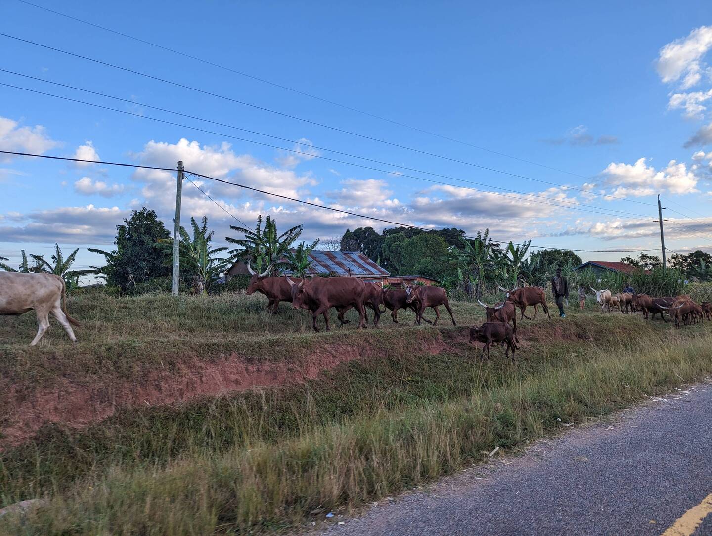
As it had been a while since I'd been on safari I thought I'd give it another go in Malawi. I stayed in a lodge just outside of Liwonde National Park. Although it is outside the park, there is nothing stopping the animals from wandering around the lodge grounds and we had to be escorted to our huts at night. On my 1st night there we saw an elephant in the bushes not too far from the bar area. When I was escorted back to my hut the ranger pointed out the footprints that showed the elephant had been right outside my hut munching on the amarula tree. I'm kind of glad I wasn't in my hut by myself as he was trashing around outside!
The next day we were out on an early morning game drive in the park and saw loads of bucks, birds, and warthogs. The best bits were the up close encounters with elephants including one munching on a baobab tree a couple of meters away, and a family of 5 cheetahs with a kill. In the afternoon we went on a boat trip where we saw more elephants, this time swimming around in the water. At night we had a few beers around the fire pit and hoped for more nocturnal elephant sightings, but weren't so lucky that night!もっと詳しく
- 旅行を表示する
- 死ぬまでにやっておきたいことリストに追加死ぬまでにやっておきたいことリストから削除
- 共有
- 日166
- 2023年5月27日土曜日 15:08
- ☀️ 27 °C
- 海抜: 1,526 フィート
マラウイNjakwa12°4’18” S 34°42’48” E
The Ilala & Likoma Island

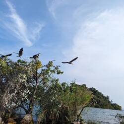
After exploring southern Malawi I headed back up to Monkey Bay where I was going to catch the Ilala ferry. Forewarned with the knowledge of the flooding this time I managed to get a kayak to the hostel, a good job too as when I arrived there was a pod of hippos merrily wallowing right at the back of the accommodation building!
The Ilala ferry was built in Scotland in 1949 before being dismantled and shipped to Malawi via Mozambique, and has been in service ferrying people and cargo up and down Lake Malawi since 1951. And believe me it's age shows! It moves at around 7 to 14 km/h and has many stops with the most inefficient system of loading & unloading passengers and cargo. Consequently it took 31 hours to make it 225 km to Likoma Island. Luckily I had one of the 7 cabins on board, complete with countless cockroaches! There were a few other tourists on board that I had gotten to know at the hostel near the port the night before who I had fun hanging out with, either chilling out in the saloon or joining the locals at the bar on the top deck.
As the journey went on the boat got busier and busier as it picked up more passengers and cargo. People sat on every available part of the deck and you had to tip toe your way around sleeping figures to get anywhere. After a night in my cabin I woke up at around 6 am to the hustle and bustle of a docking so I went for a walk on the top deck. Once I'd made a route through the sleeping people I was quite surprised to see a full blown party going on at the bar! There was a lot at drinking, singing, dancing, twerking, all while the sun had barely risen. I guess it's like being at the airport, there is no inappropriate time to get drunk on the Ilala!
Eventually we reached Likoma Island where I was disembarking. The process of embarking/disembarking at the stops without a dock is complete chaos, as in there is no system. Small boats come up beside the boat with people and cargo getting on the boat, and at the same time people and cargo getting off the boat are loaded into the small boats. This leads to lots of pushing, shoving, shouting and instability, not what you want when you have your bags with you! Because of the total lack of a system the exit of the boat on the lower deck is rammed and can take hours to clear. The other way to get on and off the boat is to just climb to/from the upper decks. After considering the people doing this to be crazy, this is exactly what we ended up doing to get off the boat! In one of the videos you can see Alice, one of the friends that I made on the boat, climbing down from the 2nd deck, and if you look you can see me popping my head out and watching how she does it because I'm about to follow! It was one of the most insane experiences that I'd been through yet while in Africa.
All of that chaos was to see Likoma Island, an idyllic island close to the Mozambique shore with nothing to do but chill. The island has golden sand, crystal clear water, and is dotted with baobabs. I stayed in a hut right on a private beach where I passed between reading on the beach and cooling off in the lake, and communal lakeside dinners at night. I also explored the island by foot and by boat, and did some snorkeling to see the brightly coloured cichlid fish.もっと詳しく
- 旅行を表示する
- 死ぬまでにやっておきたいことリストに追加死ぬまでにやっておきたいことリストから削除
- 共有
- 日176
- 2023年6月6日火曜日 14:11
- ☀️ 24 °C
- 海抜: 3,871 フィート
マラウイMsuka Mhango10°35’42” S 34°7’54” E
Northern Malawi

Once we were done with Likoma Island we had to get back to the mainland. Rather than dealing with the chaos of getting back on the Ilala Ferry I decided to get a smaller local ferry. While significantly more calm than the Ilala, it was much less comfortable. The seats were solid wood, the only shade was from a thin mesh, the boat was full of baskets and bags of several types of preserved fish, and the engine, which was near where we were sat, spewed out thick clouds of smoke which made me cough for about a month after. The journey took about 8 hours and felt excruciatingly slow as the islands we were leaving didn't appear to be getting any further away. While not as chaotic as the Ilala, getting off was still pretty crazy as once again there was no system of allowing the current passengers and cargo off before getting new people on, which lead to lots of pushing and shoving and a few people falling in the water. "This is Africa" as they say!
We eventually made it to Nkhata Bay on the mainland. Having just spent a week chilling on the beach I didn't stay long and moved onto Livingstonia after a couple of nights.
Livingstonia was founded by Scottish missionaries in 1894 high up on a plateau to avoid malaria in the lower regions. I had to get a motorbike taxi up a winding road to an eco lodge perched on the edge of the plateau, with the most beautiful view and great communal vegetarian dinners sourced entirely from their gardens. I went hiking on the plateau to take in more of the spectacular views, hiked to a waterfall that you could walk behind, and went on a tour of the town which had interesting colonial architecture. After a few days there I was back on the motorbike back down the plateau and headed back to Tanzania!もっと詳しく
- 旅行を表示する
- 死ぬまでにやっておきたいことリストに追加死ぬまでにやっておきたいことリストから削除
- 共有
- 日181
- 2023年6月11日日曜日 14:33
- ☁️ 24 °C
- 海抜: 5,295 フィート
ブルンジShanga3°49’11” S 30°4’0” E
Burundi

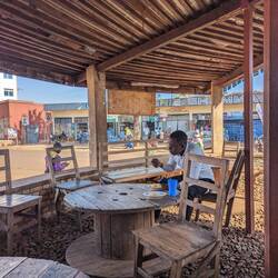
After leaving Malawi myself and another traveller Jonathan spent a few long days on busses crossing western Tanzania to get to Burundi. With only a 3 day visa in hand we only had limited time to cross Burundi to get to Rwanda. Luckily we had Jerome, a fantastic Burundian guy that helped us to navigate the country quickly. On day one we hired a car to take us to the source of the river Nile. There seem to be several sources of the Nile depending on what country you're in, but Burundi seem convinced that theirs is the right one as it is the furthest from the source! While we were there we bumped into a load of teenagers on a school trip, and we ended up in the same place as them for the other Burundian sights that we went to see too! We bumped into them later that afternoon at Karere Waterfalls , a series of beautiful waterfalls in southern Burundi.
After a night in a very local hotel and some good local food, we set off to see the Royal Drummers of Burundi. The drummers are apparently world renowned and have travelled all over the world to perform. They energetically played for 40 min in the burning heat, and the large group of students really added to the atmosphere as they cheered along and ended up dancing with them at the end. They were well worth the effort of coming to Burundi to see them!
We then headed to Bujumbura, the capital of Burundi and wandered around the city a bit. Finally we had a driving tour around Bujumbura to get more of an idea of it before saying goodbye to Jerome and heading for the Rwanda border.もっと詳しく
- 旅行を表示する
- 死ぬまでにやっておきたいことリストに追加死ぬまでにやっておきたいことリストから削除
- 共有
- 日195
- 2023年6月25日日曜日 9:13
- 海抜: 9,042 フィート
ルワンダGisasa1°27’34” S 29°30’18” E
Rwanda

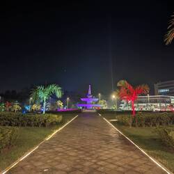
Onto Kigali, the capital of Rwanda, I spent a couple of days exploring the city which was the most developed city that I'd been in since South Africa. I visited the gut wrenching Kigali Genocide Memorial that teaches about the Tutsi genocide where over half a million people were murdered in 1994.
Next I went to Kibuye on Lake Kivu where I enjoyed the quiet and natural beauty for a few days. I went on a boat trip to see the lake and visit some islands inhabited by monkeys and fruit bats. Then I moved onto Gisenyi on the northern shore of the lake, a town with a more lively scene where I celebrated my birthday with mojitos on the lake.
Finally I made it to Volcanoes National Park in northern Rwanda for the main event, Mountain Gorilla trekking! We trekked into the jungle to see these magnificent creatures, it was so beautiful seeing them peacefully eating in their natural habitat, watching us as we watched them. The family we visited was the Amahoro family, which means peace in kinyarwanda, the local language. The family consisted of 2 silverbacks, and a range of gorillas of all ages down to young babies. We watched them in the clearing for a while then went to watch some of them climbing the trees. We're warned to keep a distance from the gorillas for their safety, but that can be difficult as they are clearly curious and wander past for a good look, even reaching out to touch at times. I felt extremely lucky to get to see them!
I also went on a trek into a bamboo forest to see Golden Monkeys, a rare type of monkey found in central Africa which were also very interesting to see as they chomped away on the bamboo.もっと詳しく
- 旅行を表示する
- 死ぬまでにやっておきたいことリストに追加死ぬまでにやっておきたいことリストから削除
- 共有
- 日210
- 2023年7月10日月曜日 16:15
- ☁️ 31 °C
- 海抜: 2,083 フィート
ウガンダWandera2°16’13” N 31°25’48” E
Uganda

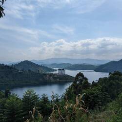
A lot of my time in Uganda was spent recovering from something - a cold in Lake Bunyonyi, and then a stomach bug in Kampala. So with time getting on before I had to get my flight out of Kenya I decided to only make one stop - to Murchison Falls National Park.
Murchison Falls (or Kabalega Falls for the Ugandan name before the Europeans "discovered" it), is on the Victoria Nile before it reaches the white Nile. The entire river is forced through a 7 meter gap at 300 cubic meters per second. This makes it the most powerful waterfall in the world, on the longest river in the world. The sheer power of the water churning when you're standing at the top of the falls is amazing, and of course you get a good drenching from the spray.
The following day we had a couple more game drives in the National Park, which is the biggest and oldest in Uganda. I saw a family of hyenas really close up, which are my favourite animals in Africa after the elephant. I also saw loads of giraffes, a leopard with an antelope in a tree, buffalo, bucks, and warthogs. We also went on a river safari where we saw more large herds of elephants and pods of hippos. We went to the bottom of Murchison Falls to see the power from that direction, and the current of the river was so powerful that the boat could only get so close, and struggled to keep even.
Finally we headed back to Kampala where I had to get a night bus onto Nairobi!もっと詳しく
- 旅行を表示する
- 死ぬまでにやっておきたいことリストに追加死ぬまでにやっておきたいことリストから削除
- 共有
- 日215
- 2023年7月15日土曜日 15:47
- ⛅ 23 °C
- 海抜: 5,863 フィート
ケニアLang'ata1°22’10” S 36°44’57” E
Western Kenya

After nearly eight months I have reached my final country in Africa! I arrived in Kenya on a night bus from Kampala, which is never the most comfortable way to travel. On my first day in Nairobi I met an Australian woman called Michelle in my hostel that I ended up travelling with for a couple of weeks. We went to the National Museum of Kenya, and then to the Giraffe Centre where you could get up close and feed the Giraffes. The following day we went on a walking tour of central Nairobi with one of the hotel staff, which was pretty interesting, and you wouldn't want to do it alone without a local to guide you. My favourite part was probably the busses, or "matatus", which are all decorated with various famous people and fictional characters, and usually have coloured lights and very loud music blaring from them! It was also the first time that I directly witnessed corruption as some railway security guards tried to get us to pay them as we hadn't followed "the proper procedure" to be allowed to take photos. Much to their annoyance Michelle and I just walked off, but the guy from the hotel and another tourist Mathias went to the office to sort it out. Of course the rules for the proper procedure didn't exist, and Mathias just flashed his Swiss ID claiming that he was a diplomat and would call the embassy to sort it out - and the security guards all swiftly backed down!
As Kenya was my last African country on this trip I had to make the most of it and do one more safari! As it was the time of the great migration we headed to the Masai Mara to try and see some of it. Millions of herd animals such as wildebeest and zebra migrate back and forth across the Serengeti and Mara, and in July/August they cross from Tanzania into Kenya across the Mara River. At this time the plains are covered with animals as far as the eye can see! We also saw some other interesting sights that I hadn't seen on safari yet, which included some giraffes fighting by swinging their heads and necks at each other, and some hyenas, jackals, and vultures all tucking into the same carcass.
After the Masai Mara we headed to Lake Naivasha, where we did a boat trip to see some interesting birds including pelicans, storks, and fish eagles, plus a pod of hippos. In the afternoon we visited Elsmere Lodge, the home of Joy and George Adamson of Born Free fame, who raised Elsa the lion and other rescued animals to release into the wild. The story of Joy Adamson was really interesting, but I particularly enjoyed the free afternoon tea and watching the colony of colobus monkeys in the garden!
Another day and another great lake in Africa, next we were off to Lake Nakaru. The draw here is the large flocks of greater and lesser flamingos. What I was not expecting was to get so close to 5 white rhinos! Up until now I had only had very distant sightings of lone rhinos, and this park had both black and white rhinos. The black rhinos were hidden away from the road with a new baby, but the white rhinos were happily chomping away at the grass just meters away from the van. This was an amazing sighting in itself, but at the same time there was a pride of lions on the other side of the road chowing down on a young buffalo. It was quite stressful as I didn't know what direction to look in! For a few minutes the rhinos were forgotten as the whole pride including the cubs came right to the road to take a drink from a very dirty looking puddle. I guess there is less chance of a crocodile lurking or a surprise hippo attack coming from a puddle!
Lastly, we went to Hell's Gate National Park, the landscape which inspired the gorge scenes in The Lion King where the wildebeest stampeded and killed Mufasa! Luckily there are no lions there so it is pretty safe to cycle through the park to see the giraffes, zebras, and buffalo, although you're not allowed into the gorge any more due to the risk of flash floods.
The nature and wildlife in Africa is spectacular and I don't think I'll ever get tired of going on safari! But with my itch for safari temporarily scratched, off we headed back to Nairobi...もっと詳しく
- 旅行を表示する
- 死ぬまでにやっておきたいことリストに追加死ぬまでにやっておきたいことリストから削除
- 共有
- 日224
- 2023年7月24日月曜日 10:40
- ☁️ 27 °C
- 海抜: 海水位
ケニアMkanda Channel2°15’8” S 40°53’47” E
Eastern Kenya

Onwards to the Kenyan coast, I took a flight to Lamu in a tiny plane, almost missing it because I didn't check which airport we were departing from! Lamu is a small island off the northeast coast of Kenya that must be accessed by air as the road is too dangerous. Lamu Town was established in 1370 and is thought to be one of the original Swahili settlements. With relatively little tourism, the town has been well preserved and mostly retains its original functions. The buildings are made of coral stone and mangrove rood, with narrow alleys that can only be passed on foot or by donkey. Donkeys are still a major form of transporting goods and people, and there are countless numbers of them just freely roaming the island, some looking a bit more healthy than others.
We flew out of Lamu and onto Kilifi, a town further south along the coast that is famous for a creek with bioluminescent algae. Unfortunately the moon was too bright to see the bioluminescence, where's the bad weather when you need it! So instead we just enjoyed the ecolodge which had a really cool swimming pool and bar area, unfortunately I was recovering from another bout of food poisoning from Lamu (beautiful place but not the most hygienic! I also met some other travellers that got sick while they were there) so I just had to enjoy the relaxed pace instead. At least I didn't have to put up with a compost toilet at this ecolodge while ill!
So giving up on the bioluminescence we headed to Diani Beach, a stunning white sand beach with bright turquoise water. We spent a few days enjoying the beach, the cocktails, the good coffee, and the good vibes. If you're ever in Kenya make sure you have a Dawa, the national cocktail made of vodka, honey, and lime. It's very delicious and very strong! Finally we went on a boat trip to do some dolphin spotting, snorkeling, and swimming at a sandbar in a marine park in the Indian Ocean.
Next we moved onto our final stop on the coast, Mombasa. Mombasa is the oldest city in Kenya, founded in around 900, and was a major port city by the 12th century. It had been controlled by various powers over the centuries and as such has a really interesting mix of Swahili, Arab, British and Portuguese influences. We didn't have long in Mombasa so we wandered around the narrow alleys of the old town, visiting the historic buildings and trying the street food. We also did a tuk tuk tour of the rest of the city, visiting the local market, the coastline where you can stroll the promenade and eat freshly fried crisps, and the giant elephant tusks, a monument to commemorate a visit from The Queen in the 1950s. Mombasa was a great city and I would have happily spent another couple of days there, but alas I had train tickets booked!
Leaving Mombasa and the beautiful Indian Ocean behind, we got the Madaraka Express back to Nairobi, by far the nicest train that I'd gotten so far on this trip. Back in Nairobi I finally said goodbye to Michelle, who was off to Tanzania to climb Kilimanjaro for her 50th birthday! I know that I said I was done with safari, but I managed to squeeze one more in before leaving Africa...
I wanted one more chance of seeing Mount Kilimanjaro so I headed to Amboseli National Park, which is just north of the mountain. The mountain is covered in cloud most of the time so you're never guaranteed to see it, but if you do you might get iconic views of elephants grazing with the mountain in the background. The safari in the national park was as always great, I saw elephants, lions, hyenas, all of my usual favourites. But no Kili... until about an hour before sunset on the 2nd night when the clouds cleared behind our lodge and had a perfect view in the twilight sky. So I didn't get the shot with the elephants, but I was still pretty happy! It was the perfect end to a great time in Africa, but now I was looking forward to the next chapter of the trip...もっと詳しく
- 旅行を表示する
- 死ぬまでにやっておきたいことリストに追加死ぬまでにやっておきたいことリストから削除
- 共有
- 日244
- 2023年8月13日日曜日 10:13
- ☀️ 27 °C
- 海抜: 935 フィート
トルクメニスタンHurmantgökje38°3’15” N 58°1’44” E
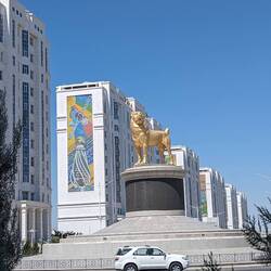
Ashgabat and the Darvaza Gas Crater
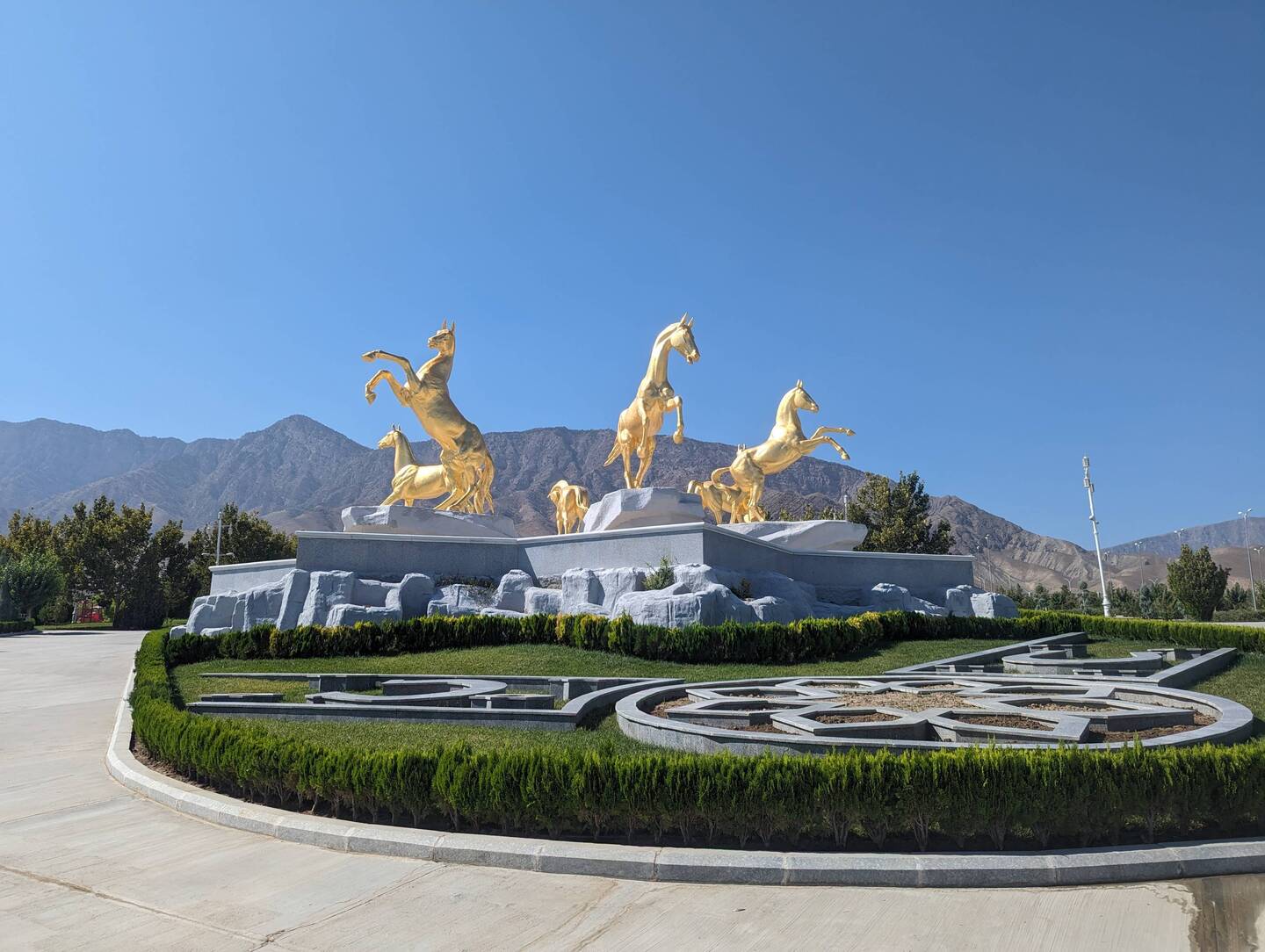
I flew out of Nairobi and into Dubai, being greeted at 4am by a 37°C temperature with high humidity. With a climate like that there was no chance of outing outside much! So I spent my few days in Dubai resting in the air-conned hotel room, and getting errands done in the air-conned malls. It was even too hot to spend time in the hotel's outdoor pool! After spending 8 months in Africa, seeing Dubai gave me a bit of culture shock, everything was pristine clean, the roads were in perfect condition and everything seemed orderly. I'm pretty sure my jaw was hanging open as I rode the metro from the airport to my hotel passing sights such as the Dubai Frame and the Burj Khalifa.
I was only in Dubai for a few days before I flew to Ashgabat, the capital of Turkmenistan. Turkmenistan is one of the least visited countries in the world, with fewer than 10,000 tourists per year. Since the fall of the Soviet Union it has been ruled by oppressive totalitarian regimes under undemocratically elected leaders. It is an isolationist country with free movement and communication severely restricted, the only internet we could access was email. No social media was allowed, and you could Google something but if you clicked the links nothing loaded. As tourists you are only allowed to enter the country if you have a guide.
Turkmenistan also owns the world's 5th largest reserve of gas, making the regime very wealthy. The president chose to show this off by demolishing most of Ashgabat in the 90s and rebuilding it almost entirely in white marble imported from Italy. The city is made up of wide avenues lined with grand buildings made of white marble, and countless golden monuments. At night everything is lit up in bright neon colours until 4am, making it an impressive city to land in on a night flight. Many of these buildings sit empty, and for the size of the city you don't see many people or cars around giving it the feel of a ghost town in many areas. The cars that you do see are all white, because in the words of our guide, "having a white car is not a requirement, but a recommendation from the president".
On day one in the city we had a tour where we took in many of the monuments, the largest indoor Ferris wheel in the world, the wedding palace, and the Russian bazar where we tried the best melon I've ever tasted and had free samples of caviar. We also went to see a display of Akhal-Teke horses, a Turkmen breed of horses known for its speed, endurance, intelligence, and for their metallic sheen leading them to be known as Golden Horses. There are only around 6600 of them in the world, most of them being in Turkmenistan, and they are adapted for the harsh desert environment that they live in.
Next we got into some 4x4s and headed into the middle of the desert to the Darvaza gas crater, aka "The Door to Hell". This isn't actually a crater but is a sinkhole caused by some sloppy soviet engineering. There are a few of these sinkholes dotted around the desert and no one is quite sure exactly how they were formed. They are leaking gas and the Russians have admitted that they set the Darvaza crater on fire to try and burn off the gas supply. Fifty years later and the crater is still burning and is showing no signs of running out of gas supply yet. We camped in the desert and watched the crater burn for hours into the night. As they say, fire is caveman TV, endless entertainment!もっと詳しく
- 旅行を表示する
- 死ぬまでにやっておきたいことリストに追加死ぬまでにやっておきたいことリストから削除
- 共有
- 日247
- 2023年8月16日水曜日 5:19
- 🌙 26 °C
- 海抜: 海水位
トルクメニスタンTürkmenbaşy40°0’0” N 52°59’33” E
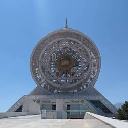
Western Turkmenistan
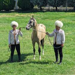
We headed back to the glitzy Ashgabat airport for an internal flight on Turkmenistan Airlines to Turkmenbashy on the Caspian Sea. We visited a Japanese POW memorial, a small Museum of Turkmenistan, and a seaside theme park with some interesting statues. Everywhere you go in Turkmenistan there are large portraits of either the current president or the previous president, who "coincidentally" happen to be father and son. These portraits are often huge, and often framed in carpet as there is a long history of carpet making in Turkmenistan.
After a night in Turkmenbashy we hopped into some more 4x4s and headed into the desert once again to visit the awe inspiring Yangy Kala canyons. These are a series of canyons and ancient sea beds unlike anything I'd ever seen before. The drivers started up a fire and we had a good local lunch at the top overlooking the incredible view, which was great except for the 42°C heat and zero shade! After lunch we headed to Balkanabat where we were stopping for a night. This was supposed to be an uneventful stopover in an admittedly retro hotel, but as we went out for dinner there seemed to be a hardcore party going on in the next room. After we'd eaten the waiters invited us to join the party, which turned out to be the women celebrating a wedding, so we joined around 200 Turkmen women on the dancefloor partying in their traditional dress to very modern tunes! Most of the people in Turkmenistan still wear their traditional clothing so we must have looked quite strange to them. It was definitely a highlight of the trip for us.
In the morning we moved on to Nohur, a traditional village in the mountains towards the Iranian border where we spent the night in a homestay. The culture in Nohur is quite distinct from the rest of Turkmenistan as being so remote they avoided soviet influence. They have their own traditions from pre-islamic days such as attaching rams skulls to graves, as they are sacred animals that are believed to fight off evil spirits and guide the souls to heaven. There is a centuries old tree at the heart of the village with a hollow that fits several people. This tree is a bit of a pilgrimage site for local people and we saw many people visiting it. At the homestay we had a great home cooked dinner of soup and plov (a central Asian version of pilau or biryani), and more delicious melon. We then spent the evening watching the stars which were really clear that far up in the mountains, we even saw the Space X satellite train which was a bit creepy, it looked like a moving snake of stars.
On the way back to Ashgabat we stopped at another pilgrimage site of the shrine of Paraw Bibi, according to legend a beautiful and virtuous woman who disappeared into the mountain when invaders were coming for her, preserving her purity. Turkmen make pilgrimage to the site of her disappearance for fertility and a cure for insanity. At the base of the hill there is a facility for the pilgrims to rest and eat, which we visited and had the chance to meet some of the pilgrims who were very curious and welcoming, insisted on giving us food and wanted selfies.
We also stopped at a large cave with a hot spring pool at the bottom which supposedly has many health benefits. It all looked a bit murky to me so I gave that one a miss...
Finally we visited Nisa, a UNESCO site of a Parthian Fortress from 3rd century BC to the 3rd century AD, and then a horse farm where we saw another display of Turkmen horses, and a very cute puppy of a Central Asian Shepherd Dog.
Due to the strict regime, tourists need to be supervised by a guide at all times while in Turkmenistan. However I was allowed to get an overnight train without a guide from Ashgabat to the Uzbekistan border. I had the chance to meet local people on the train, who happily insisted on sharing their food and tried to make conversation with me in a mix of their basic English and my basic Russian. There was one teenage boy in the next carriage with perfect English that mostly wanted to talk to me about how much he loved Billie Eilish! The next morning I was picked up at the train station by my compulsory guide, made a quick stop at Konye Urgench, an important archeological site on the old Silk Road dating from the 11th to the 16th century. Then I was dropped at the border to head to Uzbekistan...もっと詳しく
- 旅行を表示する
- 死ぬまでにやっておきたいことリストに追加死ぬまでにやっておきたいことリストから削除
- 共有
- 日254
- 2023年8月23日水曜日 13:08
- ☀️ 34 °C
- 海抜: 174 フィート
ウズベキスタンMo‘ynoq Shahri43°47’2” N 59°1’26” E
Nukus & Moynaq

I crossed the land border from Turkmenistan into Uzbekistan and arrived in Nukus, the capital of the Karakalpakstan region in the west. Karakalpakstan is mostly desert and is sparsely populated. It is also home to the Aralkum Desert, what used to be the Aral Sea. The Aral Sea was the 4th largest lake in the world, but unsustainable irrigation projects by the Soviet Union in the 1960s onwards led the lake to nearly entirely dry up, with less than 10% of the lake remaining. What remains of the lake became too salty and toxic for any fish to survive which led to the collapse of the fishing industry, and the dry land is a source of toxic dust that pollutes the air creating a public health hazard. I visited Moynaq, once a prosperous fishing village on the shore of the Aral Sea that is now 150km away. There are ruined boats stranded in the desert serving as an eerie reminder of the not too distant past. On the way back from Moynaq I picked up hitchhiker Garima, an Indian girl that had been travelling for 6 years and was on her way to Afghanistan solo. If anyone thinks I'm brave for doing what I do remember there are always way more hardcore people than me out there! I politely declined her invitation to go to Afghanistan with her... "We'd just need to find men to pretend to be our husbands to get across the border!"
Nukus is a modern soviet city but lacks the charm of the other cities in the region. Its isolation made it the perfect home to the Red Army's Chemical Research Institute where Novichok was created - which is partly responsible for the toxic air that now plagues the region. More positively its remoteness also led to the survival of a large collection of Uzbek and Russian art from the early 20th century. Stalin tried to eliminate all non-soviet art in this period, and sent most of the artists to gulags. Artist Igor Savitsky hid the art in this remote corner of the Soviet Union where it survived and is now on display in the Nukus Museum of Art. I'm not really an art connoisseur but it was a nice museum, and I enjoyed the local art that depicted the fishing villages that would have been commonplace at the time of painting, as poignant as it was.もっと詳しく
- 旅行を表示する
- 死ぬまでにやっておきたいことリストに追加死ぬまでにやっておきたいことリストから削除
- 共有
- 日255
- 2023年8月24日木曜日 20:24
- 🌙 29 °C
- 海抜: 335 フィート
ウズベキスタンKhiva41°23’15” N 60°22’33” E
Khiva

Khiva was my first stop along the Silk Road in Uzbekistan. It had been inhabited since the 8th century, but was just an outpost of the Khorezm region, of which the previous capital Konye Urgench I had already visited in Turkmenistan. Konye Urgench had been the most important city along the Silk Road until it had been sacked and razed to the ground first by Genghis Khan and then by Timur in the 13th and 14th centuries, leading to Khiva becoming the main capital from the 15th century.
While Konye Urgench was mostly ruins and archeology sites, with a few well preserved buildings, Khiva has the incredibly well preserved/restored walled city of Ichan Kala, the old town. You could almost say that the sites in Uzbekistan have been a bit too well restored, with very little to show for the age of these sites. But they do give you a sense of stepping back in time to walk along the cities as they were back then. Except now instead of slaves the main merchandise is souvenirs! Part of me wished that I wasn't backpacking, there were so many nice scarves, ceramics, silk clothes, bags, ornaments, textiles, and other items that I'd love to have brought home with me but just didn't have the room in my bag for! I just had to make do with some soviet badges.
I stayed inside the walls of the old town in a lovely B&B that had great views of the old town rooftops and the Islam Khodja minaret. Staying inside the walls meant that I could wander the streets early in the morning and late evenings when the day tourists had left, feeling like I had the place to myself most of the time. The highlight of the city has to be the beautifully tiled Kalta Minaret Minor, which was originally supposed to be 80m tall but was never completed.もっと詳しく
- 旅行を表示する
- 死ぬまでにやっておきたいことリストに追加死ぬまでにやっておきたいことリストから削除
- 共有
- 日260
- 2023年8月29日火曜日 13:29
- ☀️ 31 °C
- 海抜: 738 フィート
ウズベキスタンBukhara39°47’2” N 64°24’30” E
Bukhara

Back on the Soviet train I headed to my next stop on the silk road, Bukhara. Bukhara is over 2000 years old and was a major centre for islamic culture from the 8th century. It is the best preserved site showing Central Asian cities from the 11th to 17th centuries and the old town had many original minarets, madrasas and mausoleums. The most famous site is the 11th century Kalyan Minaret, an intricately decorated brick tower that apparently so impressed Genghis Khan that he ordered that it be spared when the rest of the city was destroyed by his army. It is also known as the Tower of Death because until as recently as the 20th century, criminals were executed by being thrown from the top. These days it's beautifully lit up and I was lucky enough to see the supermoon next to it - it was way more impressive than the photo shows!
Other sites I visited were the 10th century Ismail Samani Mausoleum, and the Ark of Bukhara, a fort first built in the 8th century. There were also several old madrasas (places of study), and nice parks to explore.もっと詳しく
- 旅行を表示する
- 死ぬまでにやっておきたいことリストに追加死ぬまでにやっておきたいことリストから削除
- 共有
- 日263
- 2023年9月1日金曜日 22:46
- 🌙 19 °C
- 海抜: 2,365 フィート
ウズベキスタンAkmechet’39°39’28” N 66°58’55” E
Samarkand

On the fast train this time I was off to Samarkand, the last of the big silk road cities in Uzbekistan. Samarkand had a rich history with evidence of inhabitation since the paleolithic period, and like the other silk road cities has had many ups and downs, being conquered over the centuries by Alexander the Great and Genghis Khan, amongst others. In the 14th century it was conquered by Timur and became the capital of the Timur Empire. However unlike other conquerors Timur had an appreciation for the arts and spared the lives of artists, craftsmen and architects so that they could improve and beautify his capital. This resulted in some of the most impressive buildings along the Silk road being in Samarkand, such as the majestic Registan Square at the heart of the old town, a complex of Madrasas that were at the centre of the Timurid Renaissance that lasted from the 14th into the 16th centuries.
There was also the impressive Bibi-Khanym Mosque, Timur's mausoleum, and Shakhi-Zindar, a series of tombs for royal and religious leaders dating from the 11th to 15th centuries. Samarkand certainly had the most beautiful sites along the Silk road, although a lot of restoration has gone into them. I'm not sure if it was allowed but one of the security guards let us go up one of the minarets, which probably wasn't a good idea as the steps are very steep and there isn't much heath and safety! The view at the top during sunset was worth it though!もっと詳しく
- 旅行を表示する
- 死ぬまでにやっておきたいことリストに追加死ぬまでにやっておきたいことリストから削除
- 共有
- 日268
- 2023年9月6日水曜日 14:55
- ⛅ 29 °C
- 海抜: 1,522 フィート
ウズベキスタンFrunzenskiy Rayon41°18’55” N 69°16’51” E
Tashkent & Margilan

Next I was in a shared taxi to Tashkent, the capital of Uzbekistan. Tashkent was also a major player on the silk road, but after being destroyed by an earthquake in 1966 it was rebuilt by the Soviet Union as the model soviet city so little remains of its silk road history. Soviet cities are characterized by wide tree lined avenues, large parks and plazas often with fountains or large monuments at the centre, grand brutalist architecture for state buildings and numerous uniform apartment blocks, and large mosaics and murals dotted around. I find these cities fascinating and spend hours wandering around checking out the architecture and hunting for mosaics.
Tashkent was the 4th largest city in the USSR at the time of its rebuild and is home to the first metro in Central Asia, which was modelled on the famous Moscow metro. Each station is different but they are all grandly designed, often with murals and chandeliers. The actual trains seem to be from that time period as well! Another iconic soviet relic is Hotel Uzbekistan, a brutalist masterpiece that hasn't changed much on the inside since it's completion in 1974. However after independence from the USSR the monument to Karl Marx outside was replaced with a large Timur of silk road fame.
After spending a while wandering around the tree lined streets of Tashkent enjoying the architecture and good coffee, I was back on a slow train to Margilan in the Fergana Valley. Silk has been produced in the Fergana Valley for thousands of years. Margilan became the centre of its production and it is still the major industry in the area, making Uzbekistan the 3rd largest silk producer after China and India. I visited the Soviet era Yodgorlik Silk Factory, where they still produce silk in both the traditional way on manual looms, and using mechanical looms, which were pretty interesting in their own right as they were original soviet era machines. I was impressed they were still going!もっと詳しく
- 旅行を表示する
- 死ぬまでにやっておきたいことリストに追加死ぬまでにやっておきたいことリストから削除
- 共有
- 日282
- 2023年9月20日水曜日 17:00
- ☁️ 17 °C
- 海抜: 2,572 フィート
キルギスタンBishkek railway station42°51’54” N 74°36’29” E
Bishkek

Leaving Uzbekistan I crossed over into Kyrgyzstan by land. I stayed in Osh for a couple of days doing research into a pamir highway trip, and then moved straight onto Bishkek, the capital. Bishkek is yet another soviet city that I spent many days wandering the streets checking out the architecture, museums, monuments and bazaars. Great places to just chill out for a while.もっと詳しく
- 旅行を表示する
- 死ぬまでにやっておきたいことリストに追加死ぬまでにやっておきたいことリストから削除
- 共有
- 日286
- 2023年9月24日日曜日 13:37
- ☀️ 15 °C
- 海抜: 5,807 フィート
キルギスタンKarakol42°29’11” N 78°24’23” E
Karakol

After sufficient time chilling in Bishkek I headed to Karakol in the east for some trekking in the famously beautiful Kyrgyzstan mountains. First I enjoyed spending time in Karakol itself, previously a small Russian outpost that has become the fourth biggest city in Kyrgyzstan, that being said the population is still less than 100,000 so it feels like a small town. It's also the main jumping off point for trekking which means that a lot of travellers congregate here making it another nice place to hang out. Some of the sites include the Russian Orthodox Cathedral made out of wood, the Dugan mosque for the Chinese Muslims that looks more like a Chinese temple, and the colourful Russian houses.
Further afield there were some nice day hikes, and a trip to Jeti Oguz, a soviet sanatorium. Stalin enshrined the right to rest in the 1936 constitution - labourers needed a two week rest in one of the many sanatoriums throughout the Soviet Union. This is one of the few that still survives and is still in use, although it was looking a little past it's prime. Supposedly the cosmonaut Yuri Gagarin stayed here to recuperate after returning from space. If you fancy it you can still get treatments here including radon baths and electrocution treatments. Needless to say I gave this a pass, but I did drink from the health giving spring which has a long list of minerals in it, including radon. The sign says that you shouldn't drink from it without guidance from your doctor, but our taxi driver insisted that everyone drinks from it and indeed there were people there filling up large vessels with the water to take home. It tasted like sucking on copper pennies and surprisingly I didn't get sick!
It was getting a bit late in the season to do the high hikes because of snow, thankfully as altitude does not like me! So I set off with some hikers from the hostel to Altyn Arashan, a valley 3000 meters above sea level and home to several hot springs. We did this hike over two days, hiking up to the valley and spending the night in a guest house heated by spring water. After the long hike we soaked in the springs to ease our muscles. Some of the springs were excruciatingly hot! Luckily there were some slightly cooler ones that were a bit more relaxing. Then there was a good communal dinner and lots of tea. The following morning we visited an outdoor spring before heading back down the mountain. The scenery on this hike was stunning, very alpine with snowy peaks, crystal clear rivers and horses roaming around.
I loved Karakol and was intending to stay a bit longer to see more of the sights and do more hikes, but then I got word of other travellers wanting to go on the pamir highway in Tajikistan so I had to head off to meet them!もっと詳しく
- 旅行を表示する
- 死ぬまでにやっておきたいことリストに追加死ぬまでにやっておきたいことリストから削除
- 共有
- 日297
- 2023年10月5日木曜日 15:04
- ⛅ 4 °C
- 海抜: 11,640 フィート
キルギスタンChong-Alay39°29’44” N 72°55’11” E
Osh & Sary Mogul - Pamir Highway part 1

I headed back to Osh via a couple more days in Bishkek as I'd managed to arrange a ride share for a Pamir Highway trip. The Pamir Highway is a mountain road through the Pamir mountains, built in the 1930s by the Soviet Union for transporting troops and provisions. It is one of the highest roads in the world and is famous for being a spectacular journey.
I met up with my ride-share mates Ed from London and Huyên from Vietnam and we hit the highway for our 7 day trip. The flatlands of Osh soon gave way to mountains and village life, we headed over the Taldyck Pass at 3600m (12,000ft) and on towards Tulparkol Lake and hiked to the viewpoint of Lenin Peak.
As it was so late in the season it was freezing by night and way too cold for sleeping in the yurt camps, so we all voted to head to a nice heated guest house with hot water in Sary Mogul village, where we had lots of hot tea and hearty Central Asian food. Central Asian food typically consists of dumpling or noodle soups, meat dumplings, plov (like pilau) and stewed meat. Not my usual fare but perfect for this weather!もっと詳しく
- 旅行を表示する
- 死ぬまでにやっておきたいことリストに追加死ぬまでにやっておきたいことリストから削除
- 共有
- 日298
- 2023年10月6日金曜日 11:23
- ☁️ 2 °C
- 海抜: 12,976 フィート
タジキスタンQarokŭl38°59’28” N 73°33’22” E
Murgab - Pamir highway part 2

Conflict between Kyrgyzstan and Tajikistan resulted in the border closing in 2021, only opening for foreign tourists again in July 2023. The border is still closed for locals which meant that we had to change vehicles and drivers in the miles of mountainous no man's land. We had to say goodbye to our nice Kyrgyz driver (who's name I can't remember) and meet up with our Tajik guide Kanybek and driver Abu. We needed special permits to enter this part of the country due to the proximity to China and Afghanistan, so after a thorough checking of our paperwork by the supposedly notoriously corrupt border guards, we were allowed through without issue. It took longer for us to exit Kyrgyzstan than it did for us to enter Tajikistan.
The Kyrgyz/Tajik border is already pretty high, with the first snow I'd really seen close up on this trip. Shortly after the crossing we passed through Akbaital pass, at 4655 meters (>15,000 ft) it's the highest pass that we'd be driving through on the highway. My head was already pounding from the altitude!
We drove to the beautiful Karakul Lake before heading to Murgab village, where we stayed the night in a home stay run by Kanybek's family. Nearby the village there's a Snow Leopard sanctuary where we got to see a Snow Leopard that had been rescued as a cub. The poor thing looked pretty disgruntled to be there, but all 3 leopards at the centre were being rehabilited for release. Snow leopards are incredibly rare and elusive so to see one up close was awe inspiring and something I never thought I'd see.もっと詳しく
- 旅行を表示する
- 死ぬまでにやっておきたいことリストに追加死ぬまでにやっておきたいことリストから削除
- 共有
- 日299
- 2023年10月7日土曜日 12:39
- ☀️ 5 °C
- 海抜: 13,632 フィート
タジキスタンDzharty-Gumbez37°34’3” N 74°10’26” E
Pamir Highway part 3

Day 3 of the Pamir Highway trip was mostly more of driving through some of the most beautiful scenery that I've seen. We stopped by a large "crater", an old soviet observatory, and some petroglyphs, which were all very cool but we're mostly just things to aim for as we headed through the mountains. My highlight was the huge herd of yaks!
We ended up at a very remote hot spring guest house. Being so high up it was absolutely freezing so getting to the toasty guest house that was heated almost too much by the hot spring water was a luxury. The actual hot springs were less of a luxury as they were so hot it was almost unbearable to be in them! It was more an exercise of endurance than of relaxation, but I managed it for a while at least. And the stars were incredible in such a remote location!もっと詳しく
- 旅行を表示する
- 死ぬまでにやっておきたいことリストに追加死ぬまでにやっておきたいことリストから削除
- 共有
- 日300
- 2023年10月8日日曜日 9:02
- ☀️ -2 °C
- 海抜: 13,468 フィート
タジキスタンKhargŭsh37°23’15” N 73°6’39” E
Pamir Highway part 4

We continued on through the stunning scenery, stopping to see some crystal clear lakes and a rather unimpressive, but still quite pretty geyser. We passed through Kargush pass at 4244m, and there was an option to hike to a view point at 4800m but considering that my head feels like it's about to implode at any height above 4000m I decided to give that a miss!
Later in the day we had to get our permits out for inspection as we reached the Afghanistan border in the Wakhan valley, along which we were going to be driving for the next few days. Just before nightfall we saw an Afghan caravan of horses and donkeys, and had a nice view of the Hindu Kush mountains on the other side of the border.
We stayed overnight in Langar village in another homestay with great, warming food, before continuing along the Pamir River that makes up the border. Life is pretty traditional in this part of Tajikistan, with the people being traditionally dressed and mostly relying on herding and some agriculture. Things looked pretty similar on the other side of the border, with just the clothing being slightly different. Both sides of the border seemed pretty well patrolled, we passed countless groups of soldiers that all looked very young. Most of them were 18 year olds on national service. On the other side of the border we saw the occasional taliban patrol vehicle too.
The area is also historically well fortified as we visited the 12th century Yamchun Fortress perched on a high rock, and the 4th century Khaaka Fortress. Then to get some R&R we managed to squeeze in two hot springs! One was built into a rock, with water coming directly from the rocks, and the other was so rich in minerals that there were piles of precipitated minerals in the bath and around the water pipes. At least this time both were at a temperature that was bearable to stay inside for more than a few minutes!もっと詳しく
- 旅行を表示する
- 死ぬまでにやっておきたいことリストに追加死ぬまでにやっておきたいことリストから削除
- 共有
- 日302
- 2023年10月10日火曜日 8:41
- ☀️ 5 °C
- 海抜: 6,726 フィート
タジキスタンKhorog Airport37°30’49” N 71°30’28” E
Pamir Highway part 5 & Dushanbe

The last couple of days of the Pamir Highway road trip spent driving along dusty mountain roads through deep dramatic valleys. These roads seem to be constantly in a state of construction so we had to stop many times while the road was blocked for construction workers, sometimes for hours at a time. In these deep valleys there is no way around, so people would just park their cars up and wait in the shade of the vehicles until the road opened to let people pass.
The mountains gradually gave way to hills and gentle valleys as we got closer to Dushanbe, the capital. Dushanbe is another ex-soviet city, but a lot of its charm had been diminished as the Tajik government removed much of the old architecture and tree lined alleys. There were still some interesting monuments, including a flashy monument to Ismail Somoni, the ruler of the 10th century Samanid dynasty, whose mausoleum I had visited a few weeks earlier in Bukhara. Somoni is also the name of the currency in Tajikistan so they obviously really like this guy!もっと詳しく
- 旅行を表示する
- 死ぬまでにやっておきたいことリストに追加死ぬまでにやっておきたいことリストから削除
- 共有
- 日315
- 2023年10月23日月曜日 14:56
- ☁️ 12 °C
- 海抜: 2,615 フィート
カザフスタンMedeū43°15’41” N 76°56’51” E
Almaty

After leaving Dushanbe I headed back to Uzbekistan for a few days so that I could get a night train from Tashkent to Almaty in Kazakhstan. The train was pretty comfortable and I met a couple of other solo female travellers that were fun to hang out with while in Almaty. Almaty is yet another soviet city, probably my favourite so far. There were loads of tree lined avenues that were nice to walk around, and there are lots of interesting things to see including museums, opera houses, parks, cathedrals, bazaars, mosques, cool architecture and monuments. After spending quite a bit of time in the mountains I loved being back in a cosmopolitan city, so I spent most of the time wandering the streets and parks, visiting the cool buildings and monuments, drinking the fruit teas and eating the good noodle soups! I also made the most of the russian connection and had some good Russian food. Apples originally came from Kazakhstan and they are very proud of it, you see monuments to apples all over the city. Almaty even means "full of apples", so there are lots of good food and drink containing apples that we also tried as much of as possible!
One must do thing in Almaty is to visit the Arasan spa, a huge complex built in 1982. The spa has many types of saunas including a Moroccan hammam, a Finnish sauna, a Turkish steam bath, and a russian banya, where you're supposed to wack yourself with birch leaves and then douse yourself in freezing water from a bucket. I only did that the once! There is also a nice pool and lots of areas to relax, plus an area for treatments. I had a back massage as I'd cricked it and I was in agony the whole time and couldn't wait for it to finish! It did fix my neck though. Everything is gender separated and you have to be nude while using the facilities, with just a towel for sitting on.
While I was trying to endure the sauna one local lady called Aliya started chatting to me and asked if I'd like to go to hers for dinner one evening as she'd like to continue to practice her English, which I did. I was interested to go inside one of the Soviet blocks where she lived. The building stairwell was original but the inside of the apartment was very modern. She lived alone as her husband had died of COVID, and her children all lived abroad. She very kindly made me mushroom pancakes with salad, and she bought me some Kazakh chocolate, which was great! She then showed me around the local area a bit which was nice of her.
Just 20 minutes outside of Almaty is the ski resort Shymbulak and the highest Ice skating rink in the world. Even if like me you're not a skiing fan, you can still get the cable car to the top to see the views. Unfortunately the ice rink hadn't opened for the winter yet, which is probably for the best considering my coordination!もっと詳しく
- 旅行を表示する
- 死ぬまでにやっておきたいことリストに追加死ぬまでにやっておきたいことリストから削除
- 共有
- 日329
- 2023年11月6日月曜日 15:37
- ☀️ 6 °C
- 海抜: 1,145 フィート
カザフスタンKomsomol’skiy51°8’6” N 71°26’31” E
Lakes, canyons, and Astana

Kazakhstan is a vast country with very little public transport so the easiest way to see some of the natural highlights is to join a tour. There isn't much tourism infrastructure outside of the cities in Kazakhstan so a coach load of people are split into groups and stay in someone's house for a couple of nights, being collected every morning for the sightseeing. On the first day of the trip we hiked to visit a few lakes. Kaindy Lake was formed by a landslide during an earthquake in 1911 blocking the flow of glacial water and resulting in a sunken forest. Kolsai lake is a large lake that you can take boat trips on, so me and a few other tourists that I had made friends with went out on a pedalo.
Back in the house that I was assigned to with some other Kazakh tourists, we had a good home cooked meal of dumplings and lots of tea. Then all of the people on the trip were meeting back up for a bonfire and dancing. The other tourists I was staying in the house with couldn't speak any English, but they were nice people and we tried to chat. They told me that we were supposed to prepare a dance routine for that night's bonfire, which is something I had somehow missed in the earlier briefing! Each house group had been sent a video by the tour leaders and had to come up with a dance for it. I had no idea what was happening but I just followed my housemates lead to learn a thankfully very simple dance routine. At one point they even had me dressed in a traditional Kazakh outfit, but luckily they took pity on me and told me that I didn't have to wear it! Which I was also grateful for as it was freezing outside! We all headed over to the bonfire which warmed us up a bit, listened to some music, and then everyone did their dance routine. It wasn't as embarrassing when you see everyone else in the same boat as you! This carried on into the evening with more games and dances, again I didn't really know what was going on but it was very funny. The next day we were off to see some canyons. The largest and most spectacular was Charyn Canyon.
After my trip into the Kazakh countryside I flew to Astana, the capital. Until 1997 Almaty was the capital of Kazakhstan, what is now Astana was a small town that the previous president Nur Sultan came from. It was even named after him at one point. As a result the majority of Astana is very new and there isn't much interesting about it. There are some flashy monuments including Baiterek, the monument of the transfer of the capital from Almaty to Astana. It is supposed to symbolise the egg of a rare bird in a tree, and has an observation deck in the globe. Astana was my last stop in Kazakhstan and after a day there, which was more than enough, I flew out of Central Asia for the next part of my adventure!もっと詳しく
旅行者Wow Soph .. the cream tea sounds very colonial bet it was delicious
旅行者You were brave wading through the water .. glad it was worth it ❤️
旅行者Ooof!! A well deserved rest… eventually 🤪