


Hong Kong part 3
 December 5, 2023 in Hong Kong ⋅ ☀️ 22 °C
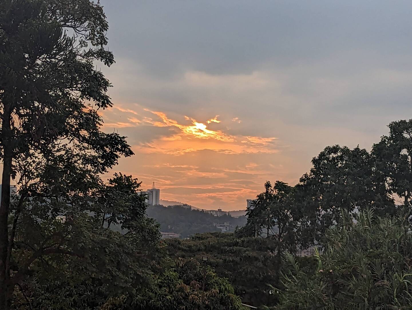
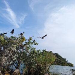
In my final few days in Hong Kong I decided to get out of the city and see some of the other islands. First up I got a ferry to Lamma Island which has a laid back vibe and some nice paths to explore.Read more


Macau
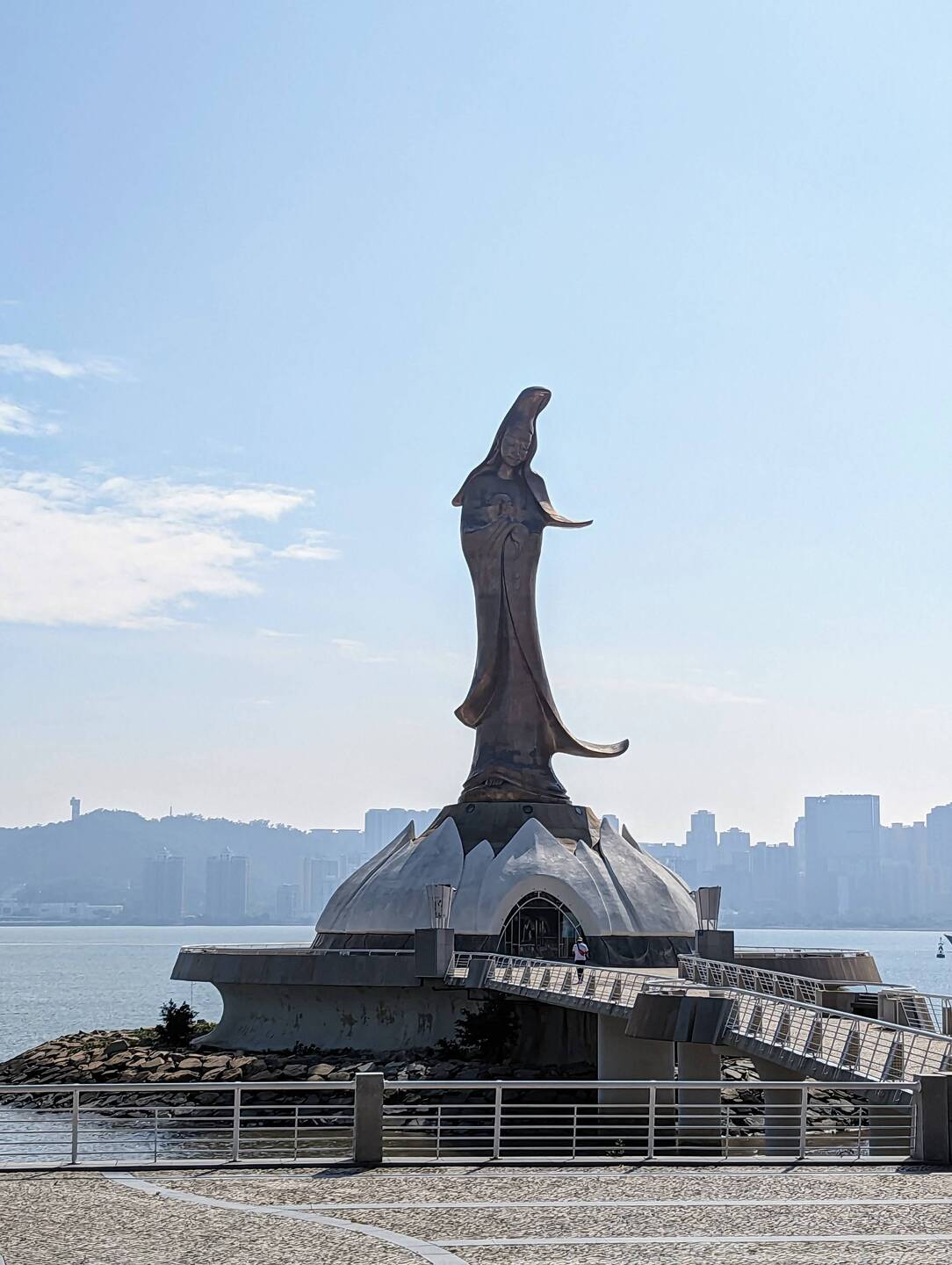
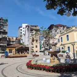
 December 3, 2023 in Macao ⋅ ⛅ 23 °C
Just a short ferry ride away from Hong Kong is Macau. Macau is a former Portuguese colony and you really get a sense of that as you wander around the historical centre, with the architecture andRead more


Hong Kong part 2
November 27, 2023 in Hong Kong ⋅ ☀️ 25 °C
My time in Hong Kong continued with more of the same, just wandering the streets seeing what wonders can be discovered down random alleys. Every street in Hong Kong is interesting in some way and IRead more


Hong Kong part 1
November 20, 2023 in Hong Kong ⋅ ☀️ 23 °C
I fell in love with Hong Kong almost immediately. I had a hostel high up on the 14th floor of a dodgy building in Kowloon, the mainland part of Hong Kong. It's a fascinating place where I couldRead more


Dubai
 November 14, 2023 in the United Arab Emirates ⋅ ☀️ 31 °C
A two hour bus ride up the coast and I arrived in Dubai, where I was very happy to be meeting up with mum for a few days! The weather was much better than when I was last here so it was pleasantRead more


Abu Dhabi
November 8, 2023 in the United Arab Emirates ⋅ ☀️ 30 °C
For the 2nd time on this trip I landed in the United Arab Emirates in the middle of the night; but unlike the first time when I landed in Dubai at 4am to 37°C heat, this time when I landed in AbuRead more


Lakes, canyons, and Astana
 November 6, 2023 in Kazakhstan ⋅ ☀️ 6 °C
Kazakhstan is a vast country with very little public transport so the easiest way to see some of the natural highlights is to join a tour. There isn't much tourism infrastructure outside of the citiesRead more


Almaty
October 23, 2023 in Kazakhstan ⋅ ☁️ 12 °C
After leaving Dushanbe I headed back to Uzbekistan for a few days so that I could get a night train from Tashkent to Almaty in Kazakhstan. The train was pretty comfortable and I met a couple of otherRead more


Pamir Highway part 5 & Dushanbe
 October 10, 2023 in Tajikistan ⋅ ☀️ 5 °C
The last couple of days of the Pamir Highway road trip spent driving along dusty mountain roads through deep dramatic valleys. These roads seem to be constantly in a state of construction so we had toRead more


Pamir Highway part 4
October 8, 2023 in Tajikistan ⋅ ☀️ -2 °C
We continued on through the stunning scenery, stopping to see some crystal clear lakes and a rather unimpressive, but still quite pretty geyser. We passed through Kargush pass at 4244m, and there wasRead more


Pamir Highway part 3
October 7, 2023 in Tajikistan ⋅ ☀️ 5 °C
Day 3 of the Pamir Highway trip was mostly more of driving through some of the most beautiful scenery that I've seen. We stopped by a large "crater", an old soviet observatory, and some petroglyphs,Read more


Murgab - Pamir highway part 2
October 6, 2023 in Tajikistan ⋅ ☁️ 2 °C
Conflict between Kyrgyzstan and Tajikistan resulted in the border closing in 2021, only opening for foreign tourists again in July 2023. The border is still closed for locals which meant that we hadRead more


Osh & Sary Mogul - Pamir Highway part 1
 October 5, 2023 in Kyrgyzstan ⋅ ⛅ 4 °C
I headed back to Osh via a couple more days in Bishkek as I'd managed to arrange a ride share for a Pamir Highway trip. The Pamir Highway is a mountain road through the Pamir mountains, built in theRead more


Karakol
September 24, 2023 in Kyrgyzstan ⋅ ☀️ 15 °C
After sufficient time chilling in Bishkek I headed to Karakol in the east for some trekking in the famously beautiful Kyrgyzstan mountains. First I enjoyed spending time in Karakol itself, previouslyRead more


Bishkek
September 20, 2023 in Kyrgyzstan ⋅ ☁️ 17 °C
Leaving Uzbekistan I crossed over into Kyrgyzstan by land. I stayed in Osh for a couple of days doing research into a pamir highway trip, and then moved straight onto Bishkek, the capital. Bishkek isRead more


Tashkent & Margilan
 September 6, 2023 in Uzbekistan ⋅ ⛅ 29 °C
Next I was in a shared taxi to Tashkent, the capital of Uzbekistan. Tashkent was also a major player on the silk road, but after being destroyed by an earthquake in 1966 it was rebuilt by the SovietRead more


Samarkand
September 1, 2023 in Uzbekistan ⋅ 🌙 19 °C
On the fast train this time I was off to Samarkand, the last of the big silk road cities in Uzbekistan. Samarkand had a rich history with evidence of inhabitation since the paleolithic period, andRead more


Bukhara
August 29, 2023 in Uzbekistan ⋅ ☀️ 31 °C
Back on the Soviet train I headed to my next stop on the silk road, Bukhara. Bukhara is over 2000 years old and was a major centre for islamic culture from the 8th century. It is the best preservedRead more


Khiva
August 24, 2023 in Uzbekistan ⋅ 🌙 29 °C
Khiva was my first stop along the Silk Road in Uzbekistan. It had been inhabited since the 8th century, but was just an outpost of the Khorezm region, of which the previous capital Konye Urgench I hadRead more


Nukus & Moynaq
August 23, 2023 in Uzbekistan ⋅ ☀️ 34 °C
I crossed the land border from Turkmenistan into Uzbekistan and arrived in Nukus, the capital of the Karakalpakstan region in the west. Karakalpakstan is mostly desert and is sparsely populated. It isRead more


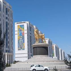
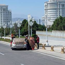
Western Turkmenistan
 August 16, 2023 in Turkmenistan ⋅ 🌙 26 °C
We headed back to the glitzy Ashgabat airport for an internal flight on Turkmenistan Airlines to Turkmenbashy on the Caspian Sea. We visited a Japanese POW memorial, a small Museum of Turkmenistan,Read more


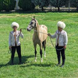

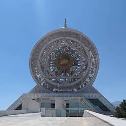


Ashgabat and the Darvaza Gas Crater
August 13, 2023 in Turkmenistan ⋅ ☀️ 27 °C
I flew out of Nairobi and into Dubai, being greeted at 4am by a 37°C temperature with high humidity. With a climate like that there was no chance of outing outside much! So I spent my few days inRead more


Eastern Kenya
 July 24, 2023 in Kenya ⋅ ☁️ 27 °C
Onwards to the Kenyan coast, I took a flight to Lamu in a tiny plane, almost missing it because I didn't check which airport we were departing from! Lamu is a small island off the northeast coast ofRead more


Western Kenya
July 15, 2023 in Kenya ⋅ ⛅ 23 °C
After nearly eight months I have reached my final country in Africa! I arrived in Kenya on a night bus from Kampala, which is never the most comfortable way to travel. On my first day in Nairobi I metRead more


Uganda
 July 10, 2023 in Uganda ⋅ ☁️ 31 °C
A lot of my time in Uganda was spent recovering from something - a cold in Lake Bunyonyi, and then a stomach bug in Kampala. So with time getting on before I had to get my flight out of Kenya IRead more

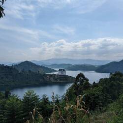
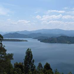


Rwanda
 June 25, 2023 in Rwanda
Onto Kigali, the capital of Rwanda, I spent a couple of days exploring the city which was the most developed city that I'd been in since South Africa. I visited the gut wrenching Kigali GenocideRead more

Get your own travel profile
Free

![]()
![]()
TravelerBreathtaking Soph. Wonderful description. xx
Traveler 🤩
🤩