


- Show trip
- Add to bucket listRemove from bucket list
- Share
- Apr 25, 2024, 12:00 PM
- ☀️ 17 °C
- Altitude: 1,894 m
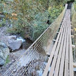
 ArgentinaMendozaDepartamento de Las HerasUspallataArroyo San Alberto32°35’7” S 69°20’51” W


Day 101–104
Uspallata, Argentinien
 April 25 in Argentina ⋅ ☀️ 17 °C
English 🇬🇧 see below.
In Uspallata fallen uns zuerst die zahlreichen schönen Pappeln auf, deren Blätter schon leicht herbstlich verfärbt sind. An der YPF-Tankstelle kaufen wir einen großenRead more


 Chile
Chile


 Brazil


Berni und Maria On Tour Genau da waren wir mit unserem WoMo auch 😉
Traveler Sehr cool! Und tolle Bilder 🥰